Tolls.
Fuel. Trip
- Calculate real-time tolls on maps
- Travel on cost-optimized routes
- Bill for tolls right after the trip
- Reimburse drivers accurately


Thousands of trucking, last-mile delivery, rideshare and other fleets save in tolls with TollGuru!
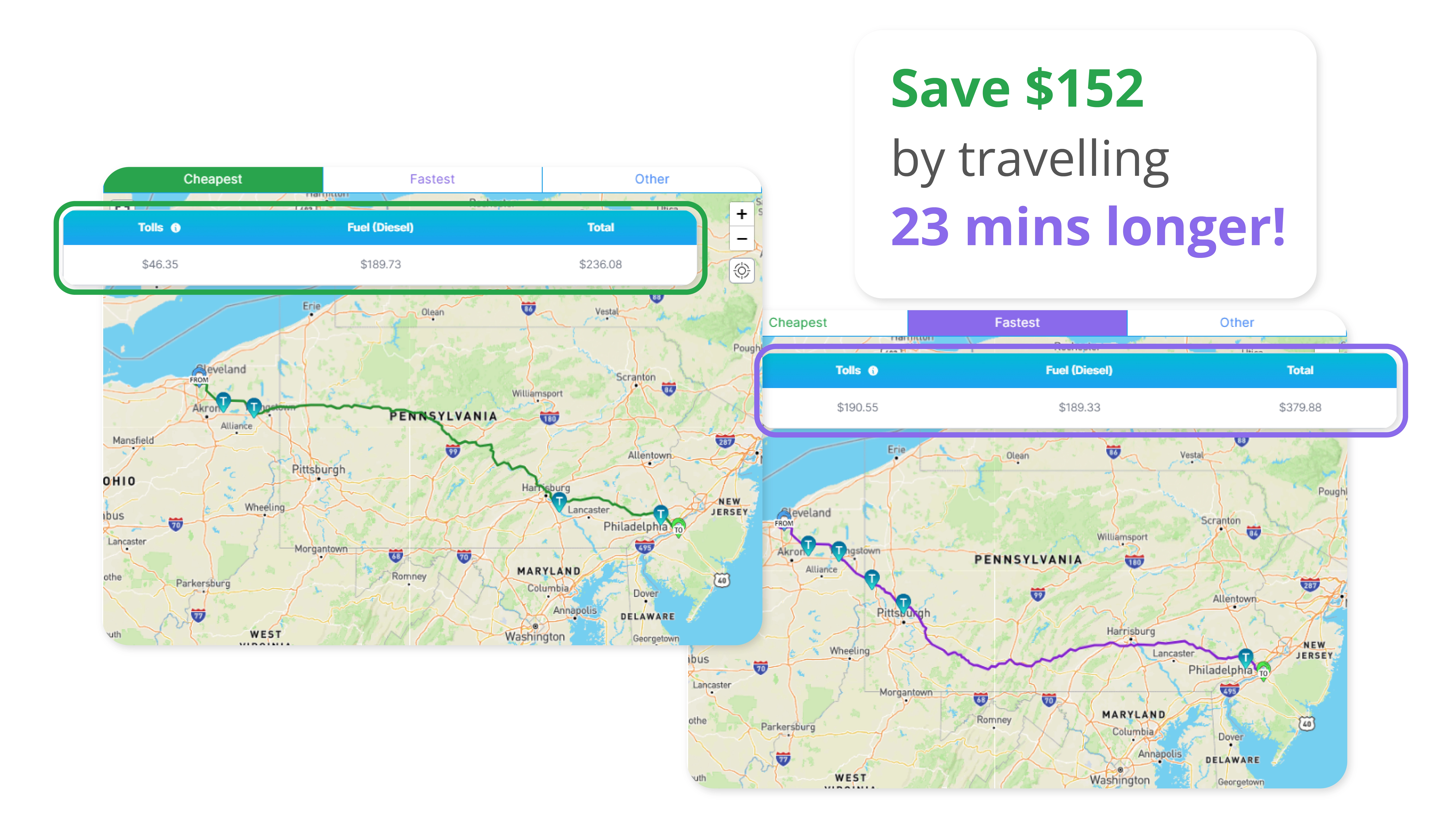
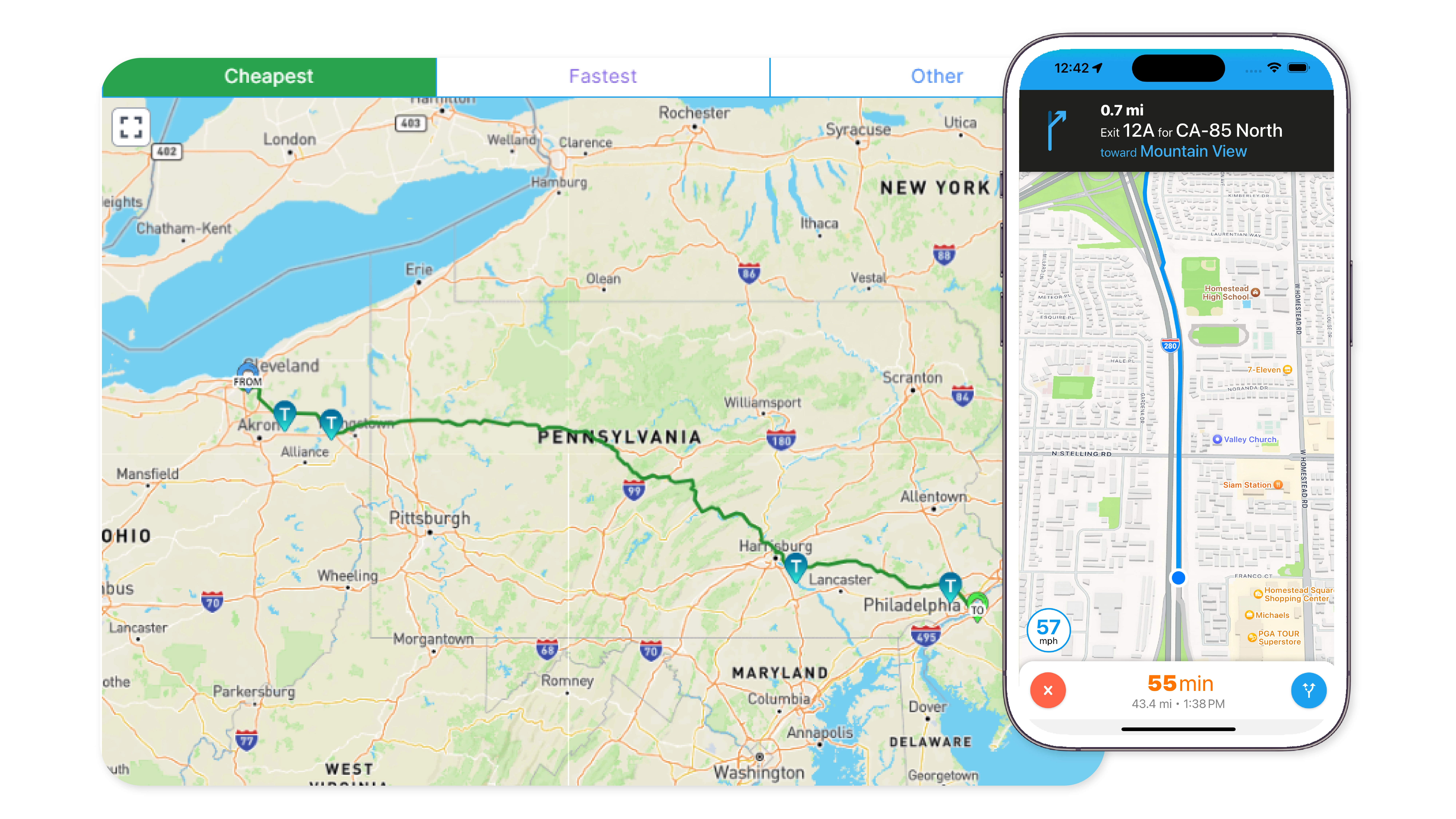
Cost & time trade-off-based cheapest vs fastest and other routes
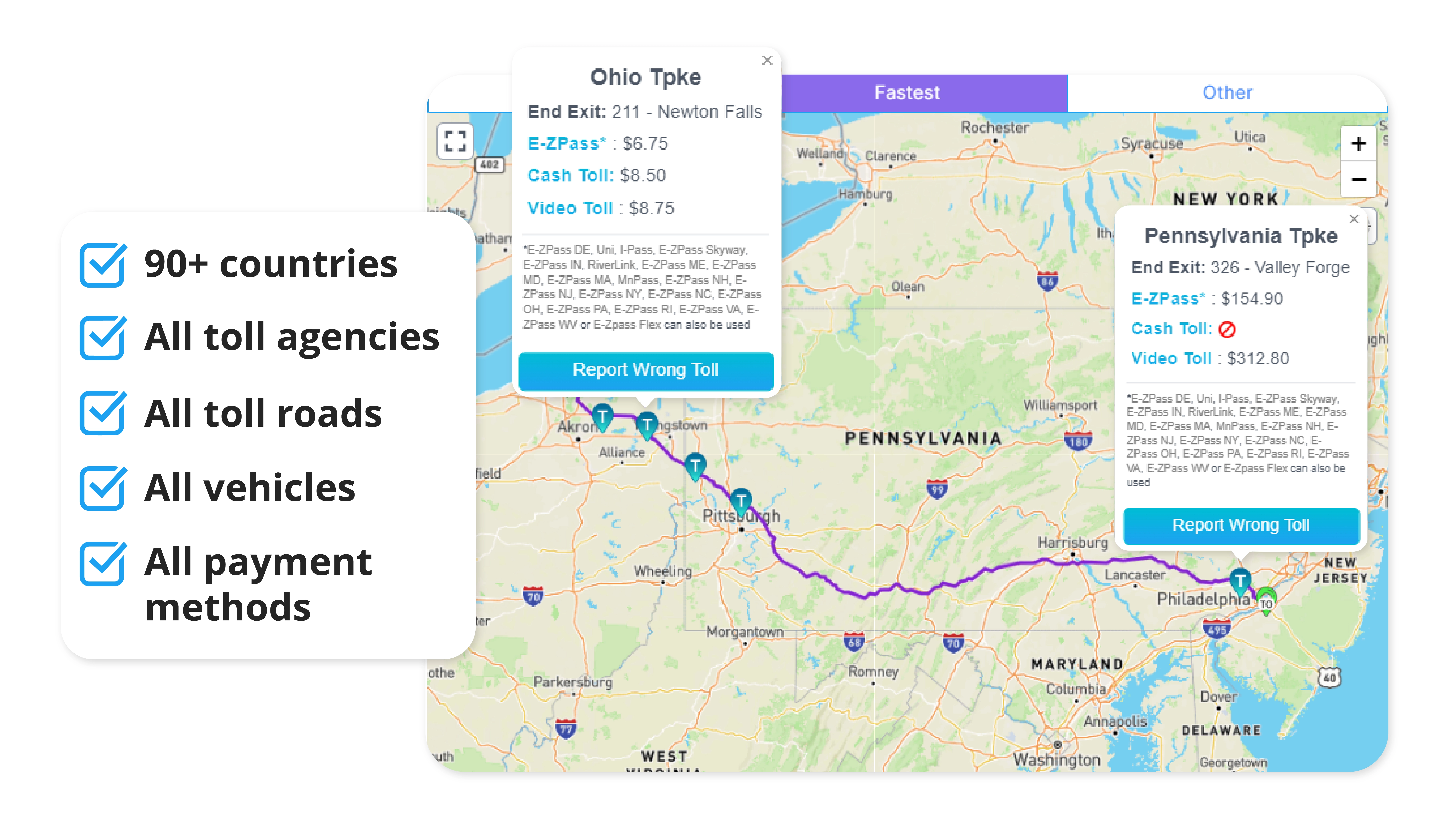
Details of all the toll plazas along the routes, along with toll charges for the different toll payment options
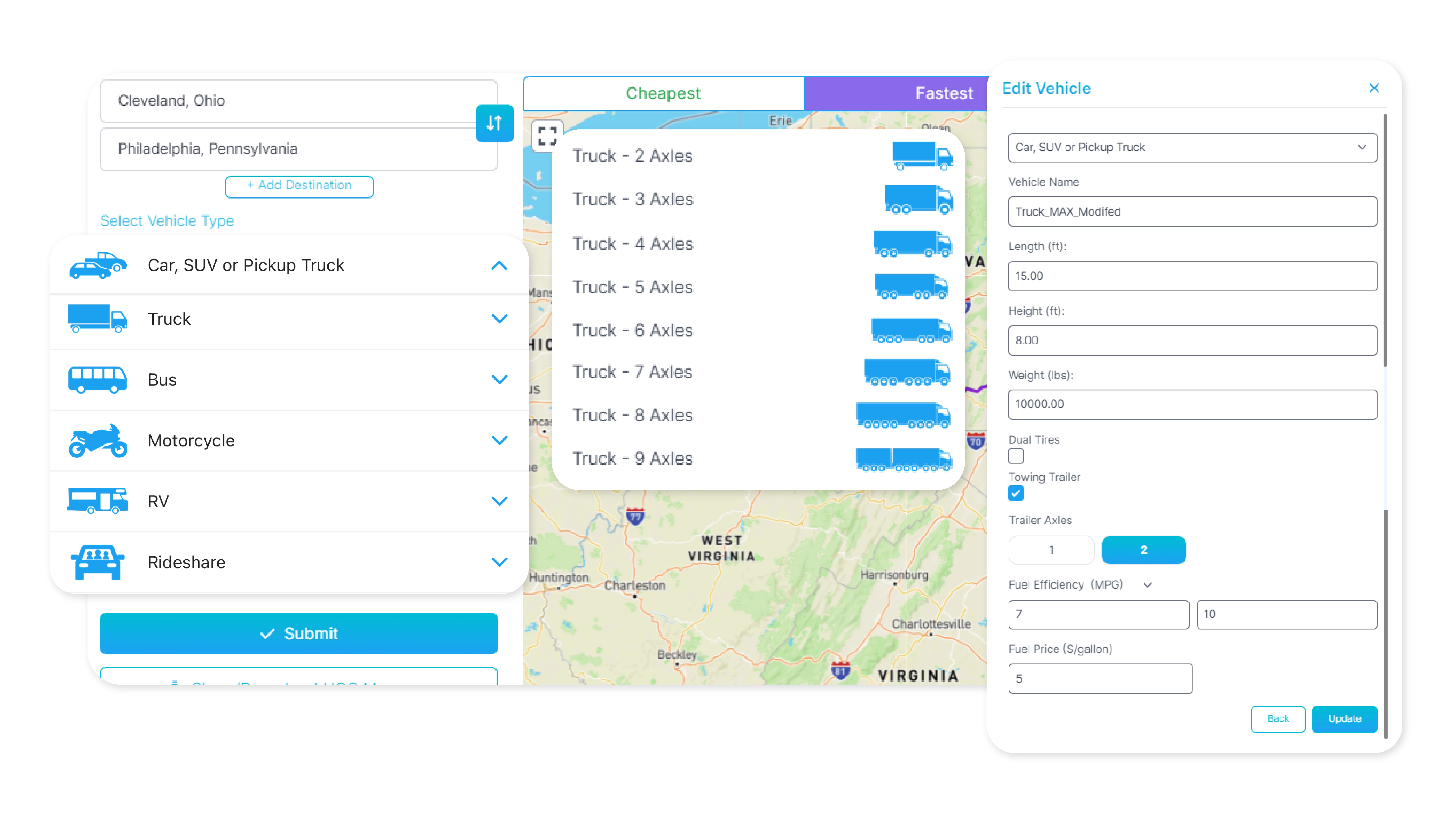
Vehicle specific toll pricing for truck, car, taxi, RV, EV, etc. based on axle-count, height, weight and other parameters
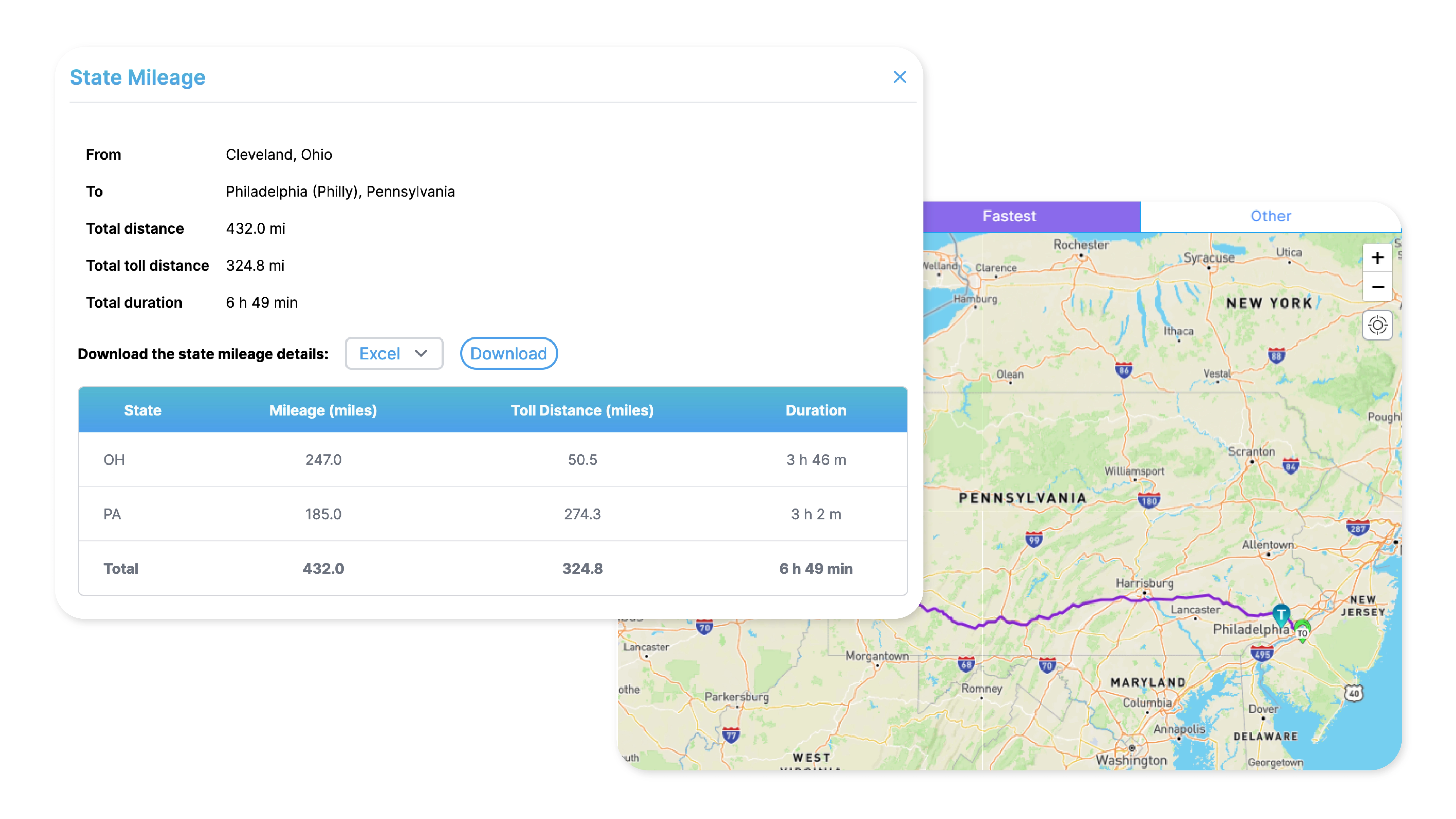
State mileage and toll miles reports for compliance
Truck-legal routes with parking, fuel, truck stops, and live GPS navigation

From pre-trip, on-trip, to post-trip, TollGuru Toll APIs make your business cost intelligent. Integrate to see costs - tolls, fuel expenses, driver charges, and others - for any route. Know the cheapest, the fastest, and compromise routes. Send GPS tracks or route polylines and accurately bill customers immediately.
The only comprehensive toll platform that covers all toll plazas, all vehicle types and all payment methods.
Countries covered
Saved in tolls
API integrations
User community
From lowering toll spend to increasing driver and customer satisfaction, discover how the world's largest fleets improve their profit margins and better serve their communities

Without any toll data in our system, we would charge just a flat markup, 20 or 30% more. That was not very sustainable. TollGuru integration made a huge difference to our operations. We were able to give our customers an exact price on deliveries and this led to much less negotiation after the fact.
Josh McCord
Co-founder & CDO
Get started with TollGuru Toll Calculator or Toll API or Cloud Services.